On occasion a visitor to Auburn Heights brings with them an item they no longer wish to keep but surmise it may be of interest to someone they know who volunteers. Such was the case recently during the August Volunteer’s Day at Auburn Heights. I was presented with a pair of original boxes containing glass plate negatives by a retired individual who volunteers with the AVRR. To paraphrase, “These probably came from a house in Cedars (near Greenbank) in the 1960s and have been in my parent’s basement since then. They may be of interest, and you’re free to do what you think best.”
One of the exposed 5” x 7” glass plate negatives the individual thought I might find of interest. While I don’t own a proper digital scanner for large glass plate negatives, I am able to perform a rough scan with my flatbed scanner using room ambient light to see what visual wonders the century-old glass plates might reveal. I digitally scanned each of the plates and converted the scan data to a positive image. As the plates were originally just lying loose in the boxes, they were more properly repacked with paper dividers and cushioning as they will eventually be added to the Thomas C. Marshall Collection at Hagley Museum & Library, where high-quality digital scanning equipment exists.
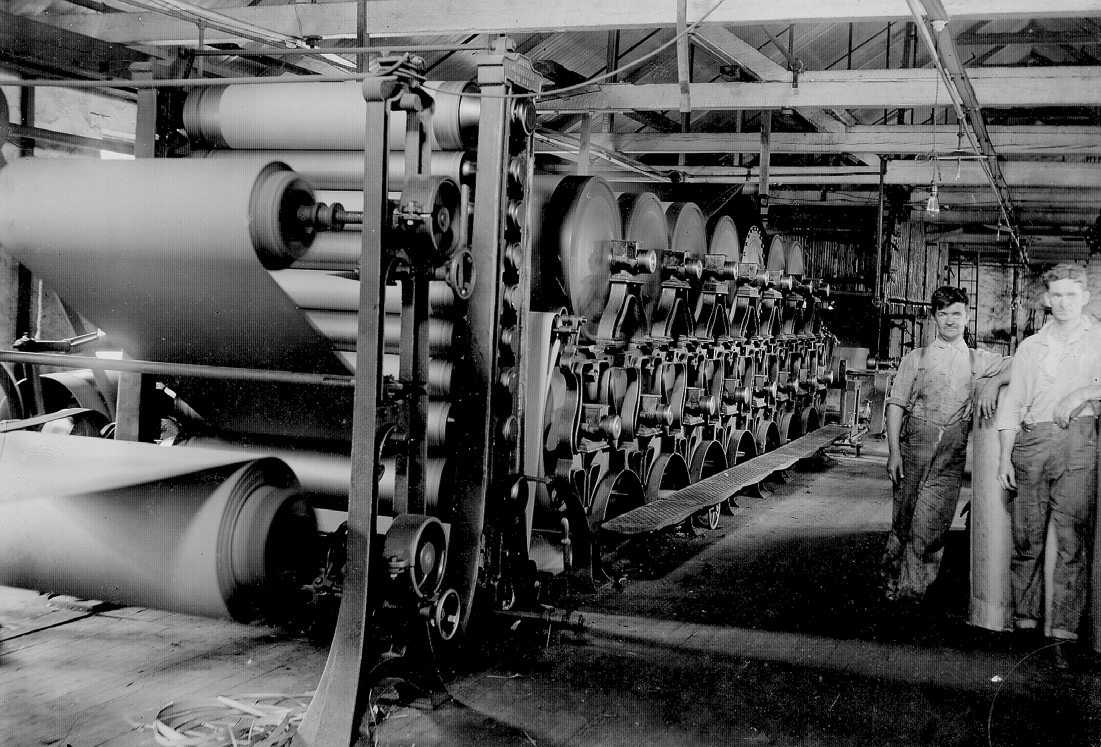
The image below was described by the giver as believed to be inside Marshall Brothers Paper Mill. After scanning, the image was studied in greater detail, and our belief is that the image is more than likely the #1 Fibre line in the #1 Fibre Mill at Marshall’s National Fiber & Insulation Company at Yorklyn. The image is definitely not the industrial rag paper process in Marshall Brother’s Mill as originally suggested. The puring tanks in the background are part of a fibre-making process and not a papermaking process. We have glass plate negatives of the Insulite Mill’s prototype endless fibre machine, and the steam heated rotating can driers in the foreground are configured differently than those of the Insulite Mill (and paper mill as well). We believe it may be the #1 Fibre Line because the configuration of equipment is very similar to Israel Marshall’s patent and what was developed in the Insulite Mill starting in 1900.

While the photographer is unknown, the fact that the glass plate negatives were manufactured by the “Stanley Dry Plate” division of Eastman Kodak Company reminds us of the many boxes of Stanley Dry Plates in the Thomas C. Marshall Collection at Hagley Museum & Library, which includes a few images similar to the above. The Stanley twins sold the dry plate business to Eastman Kodak in January 1904, which places the images after that date. For the image to be the #1 Fibre Mill, it would have to be after 1906-07 as that is the time period that the #1 Fiber Mill began operation.
Some archivists and historians, based on one image, would not agree a strong enough case has been presented to conclude the boxes of images might have been taken by Clarence Marshall. Other images, which we’ll share in the answer, indicate that if the photographer wasn’t Clarence Marshall, it was someone closely related to the family.
The image below is from another of the glass plate negatives and provides positive proof the images, if not the glass plate negatives themselves, are of Marshall origin. The building pictured is undeniably related to the Marshall family. What is the building pictured, and how is it related to the Marshalls?
Answer
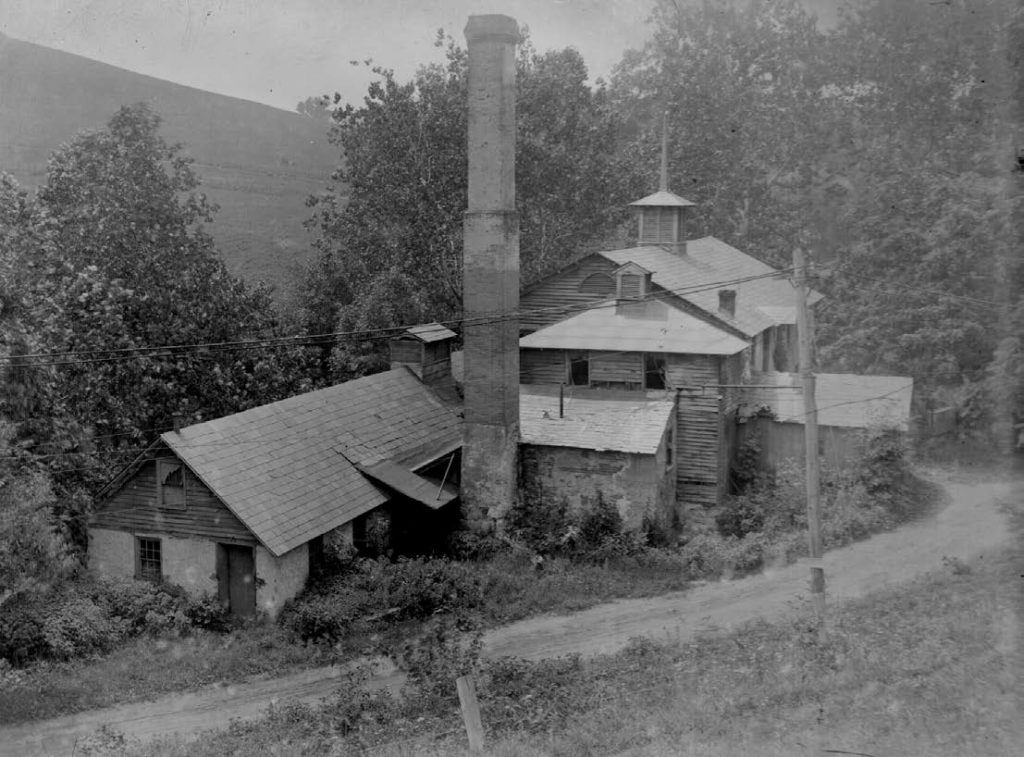
The second image of this month’s question is where the Marshall industrial rag paper involvement began – Thomas S. Marshall’s Homestead Paper Mill at Marshall’s Bridge, Kennett Township, PA. This is the mill where Israel and Elwood learned the papermaking trade from their father! Documented photos in the T. Clarence Marshall Collection at Hagley Museum & Library as well as photos in the Charles S. Philips Collection at the Chester County Historical Society confirm the mill’s identity.
A similar image dating from sometime in the 1880s has been displayed in the Marshall Museum and used for various publications. In that image the mill is definitely in operating condition as there is not the uncut growth of plants and grasses around the building. In this image, which has to be post 1904 due to being in in the Stanley-Kodak box and the timeframes of the other images, the mill looks more unused and neglected. While we don’t know the exact year when the Marshalls stopped making paper at the Homestead Paper Mill, indications are it was in the first decade of the 1900s. Marshall paper mills at Wooddale and Yorklyn were steam-powered, efficient, and offered more capacity than the primarily water-powered Homestead Mill.
The dirt road in the foreground is Creek Road (Route 82). Center right is where the road makes a sharp right heading to Old Kennett Pike. Where the road goes behind the mill it crosses the Red Clay Creek to become what we know as Marshall Bridge Road today.
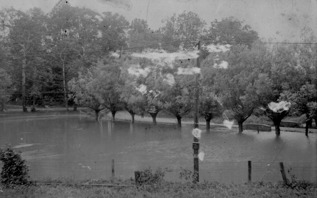
Sharing several of the other glass plate negative images, the photograph below includes the date “August 4, 1915” written on the edge of the glass plate, along with the caption “Marshall’s Meadow, Yorklyn, DE.” The photo, taken from the area where the water tower now stands, shows the West Chester, Kennett, and Wilmington Electric Railway tracks in the foreground. Benge Road is to the left, and Auburn Mill Road is just beyond the row of trees. While we’ve been amazed at the flooding of the Red Clay in recent years, especially twice in one week this past August, it is obvious from Clarence’s photography of multiple floods, the creek swelled above its banks a century ago!
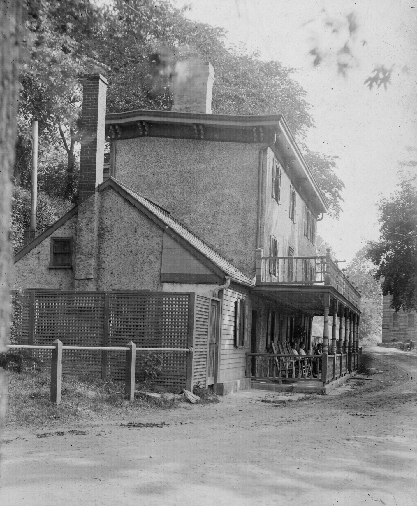
Tom Marshall wrote about the building featured below. Folks today often see the door in the white stone wall on Creek Road as you approach Yorklyn Road’s Iron Bridge and wonder what it was for. It was the door to the spring and ice house for the Snuff Mill Superintendent’s home (a Mr. Durham according to Tom), which was built in the latter 1800s. Becoming known as the “Boarding House” when it was operated by the Jackson family, in 1937 it was razed. Tom, in his writings, noted that the porch frequently collected the occasional stray autocarriage of the era! One of the Garrett Snuff Mill buildings is at the right edge of the image, the remnants still standing close to a paved Creek Road today.

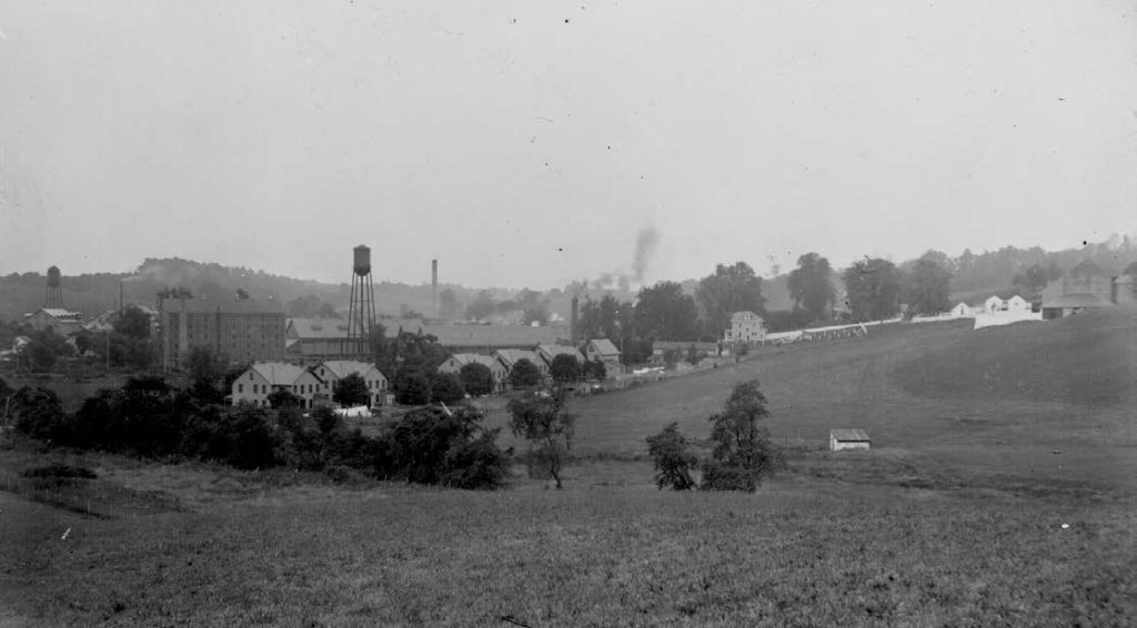
Our final image is of Yorklyn a century ago, taken from atop the high hill across from Auburn Heights. In the foreground is Lower Snuff Mill Row which were snuff mill worker’s homes. The Garrett mansion (behind trees) and 1904 constructed superintendent’s homes are center right. The Garrett Snuff Mills are in the foreground center left with Marshall’s National Fibre & Insulation mills in the distance with their water tower and tall smokestack dating the photo to sometime in the late nineteen-teens or later.